Uwaga Promocja!
Rabat -
45%
na wszystkie produkty. Podaj w koszyku kod -
BIH6GVW
Do końca oferty pozostało
Thu, 21 Nov 2024 22:59:59 +0000
6:2:4
x
O nas
Produkty
Pomoc
Kontakt
Opinie
Panel klienta
Modne i stylowe fototapety na wymiar
0
szt.
0
00
PLN
Pusty Koszyk
Menu
Przeznaczenie
Fototapety do salonu
Fototapety do sypialni
Fototapety do kuchni
Fototapety do biura
Fototapety do jadalni
Fototapety do łazienki
Fototapety do pokoju dziecka
Fototapety do pokoju nastolatka
Serie
Akwarele
Graffiti
Japonia
Pop Art
Skandynawia
Malarstwo
Żeglarstwo
Kwiaty
Motywy roślinne
3D
Miasta
Uliczki
Kategorie
Krajobraz
Lawendowe pole
Góry
Jeziora
Toskania
Plaża i palmy
Wodospad
Zachód słońca
Lasy i drzewa
Brzozy
Las bambusowy
Las tropikalny
Zamglony las
Kwiaty
Storczyk / orchidea
Dmuchawce
Maki
Tulipany
Słoneczniki
Architetura
Most Brookliński
Wieża Eiffla
Stare uliczki
Mosty
Drapacze chmur
Piramidy
Wielkie miasta
Panorama miasta
Warszawa
Kraków
Nowy Jork
Londyn
Paryż
Rzym
Wenecja
Tokio
Hong Kong
Zwierzęta
Konie
Zebra
Tygrys
Słoń
Flamingi
Jedzenie i napoje
Owoce
Warzywa
Pieczywo
Pierogi
Makarony
Pizza
Przyprawy
Kawa
Wino
Graficzne
Tropikalne liście
Damask
Etno i Folk
BOHO
Skandynawskie
3D / efekt głębi
Orientalne kafle
Geometryczne
Paski
Kółka
Fale
Kropki
Esy Floresy
Abstrakcyjne
Portret
Zwierzęta
Kwiaty
Krajobraz
Miasto
Inspiracje
Blog
Ulubione
Z Twojego zdjęcia
Opcje wyszukiwania
Typ
Fotografia
Wektor
Ilustracja
Wszystko
Położenie
Poziome
Pionowe
Kwadrat
Panoramiczne
Wszystko
Pokaż tylko
Z jednolitym tłem
Wszystko
Kolor
Na okręgu zaznacz szukany kolor a na kwadracie jego natężenie
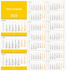
Weekly calendar for 2025, cover with empty space for photo or illustration
#1073277372
Zobacz więcej
Calendar for 2025, week starts from sunday, vector illustration
#1073276656
Zobacz więcej
Pocket calendars for 2024 2025 2026, week starts from sunday, vector illustration
#1067017796
Zobacz więcej
vector illustration, wall quarterly calendar 2025 with week numbers starting from Monday
#1073276695
Zobacz więcej
Plants, grass and flowers, white business card or postcard with copy space on light pastel background
#1039453183
Zobacz więcej
Abstract futuristic background, inverted landscape with sea reflection in sky, geometric figure circle illusion of reality
#1039444040
Zobacz więcej
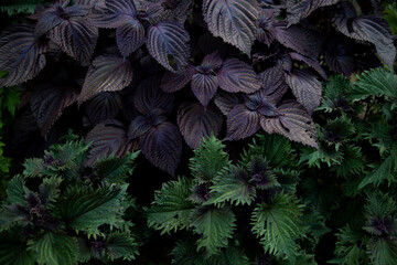
Textured green and purple basil leaves, close up of spice growing in garden
#1030056326
Zobacz więcej
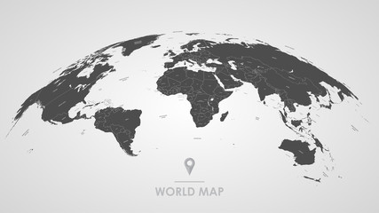
3d silhouette of a global world map, sphere with continents and islands of the world monochrome vector illustration
#309904559
Zobacz więcej
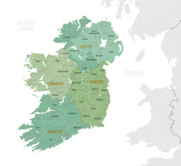
Detailed map of Ireland with administrative divisions into provinces and counties, major cities of the country, vector illustration onwhite background
#434176432
Zobacz więcej
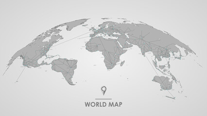
Detailed global world map, with borders and names of countries, seas and oceans, vector illustration
#309904592
Zobacz więcej
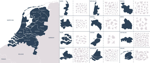
Vector color detailed map of Netherlands with the administrative divisions of the country, each Provinces is presented separately and divided into Municipalities
#482189384
Zobacz więcej
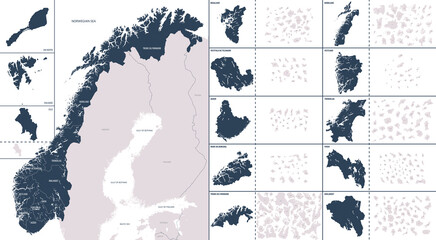
Vector color detailed map of Norway with the administrative divisions of the country, each Counties and Dependent territory is presented separately and divided into municipalities
#495270502
Zobacz więcej
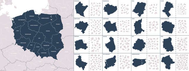
Vector color detailed map of Poland with administrative divisions of the country, each provinces (voivodeships) is presented separately in-highly detailed and divided into counties (powiats)
#483809215
Zobacz więcej
Cute background in pastel colors with copy space, newborn baby toy, teether and kids accessories made of natural material
#1030056226
Zobacz więcej
Beige adhesive tape, set of crumpled torn pieces of sticky brown tape on white background
#404559164
Zobacz więcej
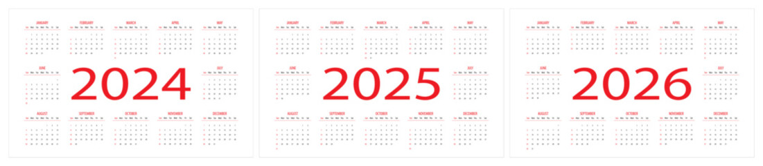
Vector illustration of calendars for 2024, 2025 and 2026, week starts on Sunday
#1052678733
Zobacz więcej
2025 calendar, week starts on sunday, daily planner template in minimalist style and pastel color, vector illustration
#1053195129
Zobacz więcej
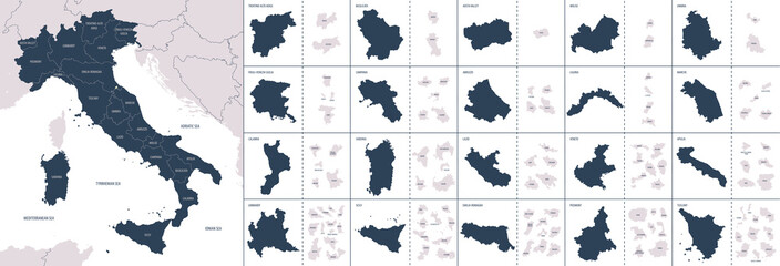
Vector color detailed map of Italy with administrative divisions of the country, each region is presented separately in-highly detailed and divided into provinces
#455740683
Zobacz więcej
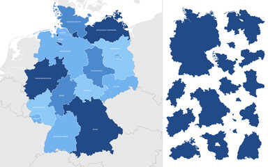
Detailed vector blue map of Germany with administrative divisions into lands and regions of the country
#399608475
Zobacz więcej
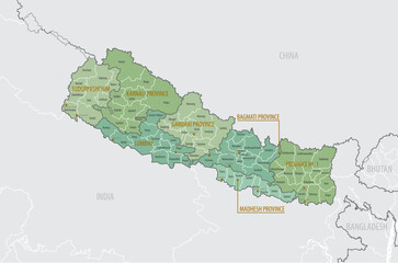
Detailed map of Nepal with administrative divisions into Provinces and Districts, major cities of the country, vector illustration onwhite background
#597967750
Zobacz więcej
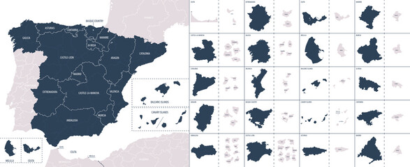
Vector color detailed map of Spain with the administrative divisions of the country, each Autonomous communities is presented separately and divided into autonomous cities and Provinces
#482173175
Zobacz więcej
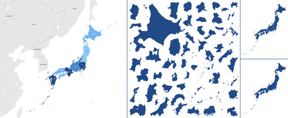
Detailed vector blue map of Japan with administrative divisions into regions and prefectures of the country
#471890627
Zobacz więcej
Pattern kids accessories, newborn baby things, children's toys made of natural wood on pastel beige background, top view, flat lay with copy space
#1002518880
Zobacz więcej
Global world telecommunication map futuristic technology, Internet networks and data exchange worldwide business, Cloud computing vector background
#513324639
Zobacz więcej
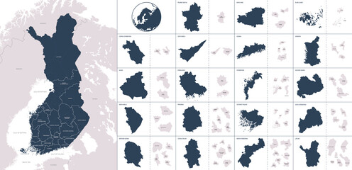
Vector color detailed map of Finland with administrative divisions of the country, each region is presented separately with high detail divided into districts and sub-regions
#471890626
Zobacz więcej
Vector, blue map of England with division into regions, counties and districts
#528281865
Zobacz więcej
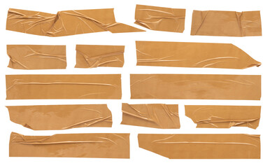
Beige scotch, large set of adhesive packaging tape, different shapes and sizes, crumpled torn strips and pieces on a white background
#404559194
Zobacz więcej
Pattern of children's toys made of natural wood, things for newborns, teether, rainbow, hare on pastel beige background, top view, flat lay
#860785756
Zobacz więcej
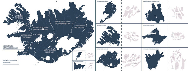
Vector color detailed map of Iceland with the administrative divisions of the country, each Regions is presented separately and divided into Municipalities
#506242016
Zobacz więcej
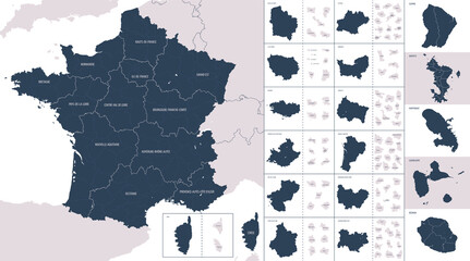
Vector color detailed map of metropolis and overseas territories of France with administrative divisions of the country, each region is presented separately in-highly detailed and divided into depart
#455740690
Zobacz więcej
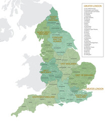
Detailed map of England with administrative divisions into regions, counties and districts, major cities of the country, vector illustration onwhite background
#529860336
Zobacz więcej
natural wooden toys and chewers cute baby background in pastel beige color with copy space, top view
#900820697
Zobacz więcej
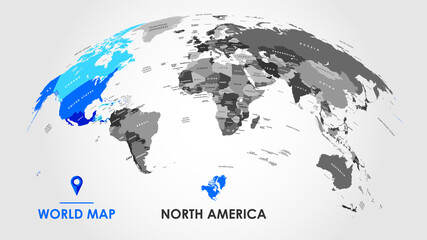
Detailed global world map, with borders and names of countries, seas and oceans, Continent of North America in colors, vector illustration
#442114769
Zobacz więcej
Cute baby toys rainbow, bear, hare, beads, star made of natural wooden material in beige color on white background with copy space
#987920992
Zobacz więcej
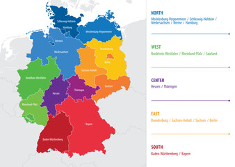
Vector map of regions of Germany
#385008518
Zobacz więcej
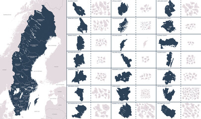
Vector color detailed map of Sweden with the administrative divisions of the country, each Regions is presented separately and divided into Municipalities
#517952881
Zobacz więcej
Capsules of vitamins and oils, medicinal herbs for skin care and healthy lifestyle, on white background, top view
#624354435
Zobacz więcej
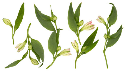
Set with beautiful branches, leaves and flower buds on white background
#632331356
Zobacz więcej
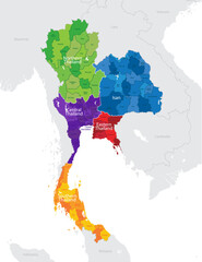
Map of the administrative division of Thailand into regions and provinces, detailed vector illustration
#590888993
Zobacz więcej
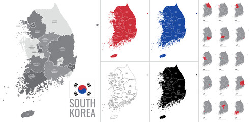
Detailed vector map of regions of South Korea with flag
#483809213
Zobacz więcej
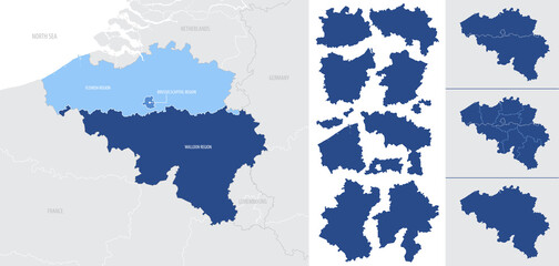
Detailed, vector, blue map of Belgium with administrative divisions into regions country
#411869919
Zobacz więcej
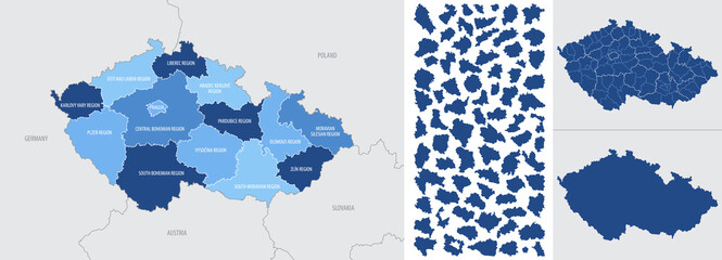
Detailed, vector, blue map of Czech Republic with administrative divisions into regions country
#414133708
Zobacz więcej
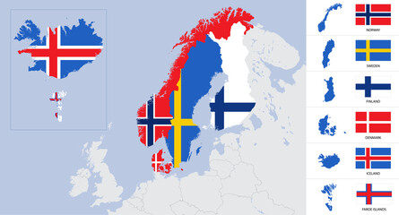
Vector detailed map and flags of Scandinavia with country silhouettes Sweden, Norway, Denmark, Finland, Iceland, Faroe islands
#391241086
Zobacz więcej
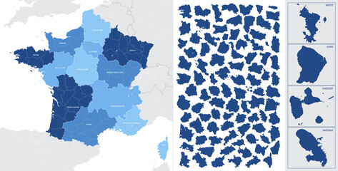
Detailed, vector, blue map of France with administrative divisions into regions and departments, metropolis and overseas territories of the country
#397825307
Zobacz więcej
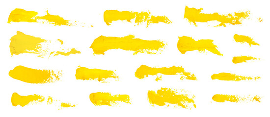
Set of yellow oil paint brush strokes, high detail abstract acrylic grunge elements, texture isolated palette knife masks on white background
#530608693
Zobacz więcej
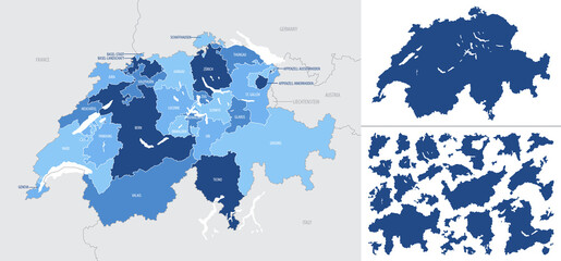
Detailed, vector, blue map of Switzerland with administrative divisions into regions country
#415733490
Zobacz więcej
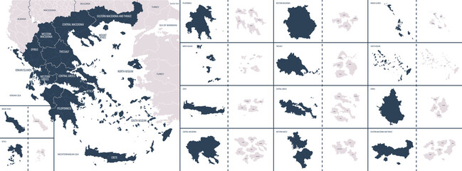
Vector color detailed map of Greece with the administrative divisions of the country, each Regions is presented separately and divided into municipalities
#502191705
Zobacz więcej
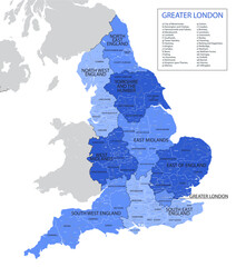
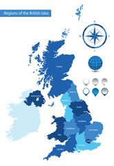
Vector map of the regions of the British Isles
#162284903
Zobacz więcej
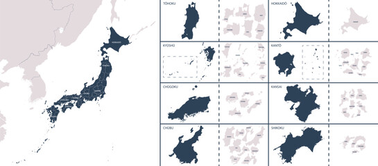
Vector detailed map Japan with the administrative divisions of the country, each region is presented separately, detailed and divided into prefectures
#523383217
Zobacz więcej
«
1
2
3
…
24
»
Copyright
Fototapeta4U.pl
2024