Uwaga Promocja!
Rabat -
45%
na wszystkie produkty. Podaj w koszyku kod -
Z5H8TBV
Do końca oferty pozostało
Wed, 25 Dec 2024 22:59:59 +0000
8:0:6
x
O nas
Produkty
Pomoc
Kontakt
Opinie
Panel klienta
Modne i stylowe fototapety na wymiar
0
szt.
0
00
PLN
Pusty Koszyk
Menu
Przeznaczenie
Fototapety do salonu
Fototapety do sypialni
Fototapety do kuchni
Fototapety do biura
Fototapety do jadalni
Fototapety do łazienki
Fototapety do pokoju dziecka
Fototapety do pokoju nastolatka
Serie
Akwarele
Graffiti
Japonia
Pop Art
Skandynawia
Malarstwo
Żeglarstwo
Kwiaty
Motywy roślinne
3D
Miasta
Uliczki
Kategorie
Krajobraz
Lawendowe pole
Góry
Jeziora
Toskania
Plaża i palmy
Wodospad
Zachód słońca
Lasy i drzewa
Brzozy
Las bambusowy
Las tropikalny
Zamglony las
Kwiaty
Storczyk / orchidea
Dmuchawce
Maki
Tulipany
Słoneczniki
Architetura
Most Brookliński
Wieża Eiffla
Stare uliczki
Mosty
Drapacze chmur
Piramidy
Wielkie miasta
Panorama miasta
Warszawa
Kraków
Nowy Jork
Londyn
Paryż
Rzym
Wenecja
Tokio
Hong Kong
Zwierzęta
Konie
Zebra
Tygrys
Słoń
Flamingi
Jedzenie i napoje
Owoce
Warzywa
Pieczywo
Pierogi
Makarony
Pizza
Przyprawy
Kawa
Wino
Graficzne
Tropikalne liście
Damask
Etno i Folk
BOHO
Skandynawskie
3D / efekt głębi
Orientalne kafle
Geometryczne
Paski
Kółka
Fale
Kropki
Esy Floresy
Abstrakcyjne
Portret
Zwierzęta
Kwiaty
Krajobraz
Miasto
Inspiracje
Blog
Ulubione
Z Twojego zdjęcia
Opcje wyszukiwania
Typ
Fotografia
Wektor
Ilustracja
Wszystko
Położenie
Poziome
Pionowe
Kwadrat
Panoramiczne
Wszystko
Pokaż tylko
Z jednolitym tłem
Wszystko
Kolor
Na okręgu zaznacz szukany kolor a na kwadracie jego natężenie
Vector Philippines map, map of Philippines for emphasizing export, technology, trade and innovation. Enhance presentations and marketing materials. Ideal for businesses, entrepreneurs.
#599035767
Zobacz więcej
Costa Rica concept map, map of Costa Rica suitable for technology, export, smart city, development and communication concepts.
#573500772
Zobacz więcej
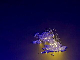
United Kingdom concept map, map of United Kingdom suitable for technology, export, smart city, development and communication concepts.
#573503000
Zobacz więcej
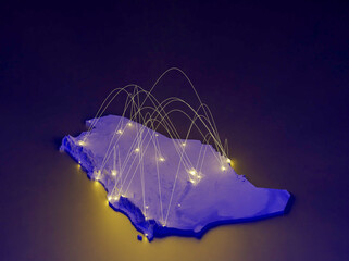
Saudi Arabia concept map, map of Saudi Arabia suitable for technology, export, smart city, development and communication concepts.
#573502433
Zobacz więcej
Vibrant Inverness, United Kingdom map - Export concept map for Inverness, United Kingdom on World map. Suitable for export concepts. File is suitable for digital editing and prints of all sizes.
#624373483
Zobacz więcej
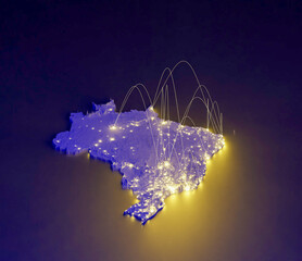
Brazil concept map, map of Brazil suitable for technology, export, smart city, development and communication concepts.
#573500512
Zobacz więcej
Vibrant Boston, United States of America map - Export concept map for Boston, United States of America on World map. Suitable for export concepts.
#614105814
Zobacz więcej
Vector Finland map, map of Finland for emphasizing export, technology, trade and innovation. Enhance presentations and marketing materials. Ideal for businesses, entrepreneurs.
#599033227
Zobacz więcej
High detailed vector Palestine physical map, topographic map of Palestine on white with rivers, lakes and neighbouring countries. Vector map suitable for large prints and editing.
#588960689
Zobacz więcej
High detailed vector Falkland Islands physical map, topographic map of Falkland Islands on white with rivers, lakes and neighbouring countries. Vector map suitable for large prints and editing.
#588960610
Zobacz więcej
Vibrant Vitoria, Brazil map - Export concept map for Vitoria, Brazil on World map. Suitable for export concepts. File is suitable for digital editing and prints of all sizes.
#644013687
Zobacz więcej
Vector world map - with Air Superiority Blue color borders on background in Air Superiority Blue color. Download now in eps format vector or jpg image.
#577154508
Zobacz więcej
Vibrant Tatvan, Turkey map - Export concept map for Tatvan, Turkey on World map. Suitable for export concepts. File is suitable for digital editing and prints of all sizes.
#636788822
Zobacz więcej
French Republic concept map, map of French Republic suitable for technology, export, smart city, development and communication concepts.
#573501078
Zobacz więcej
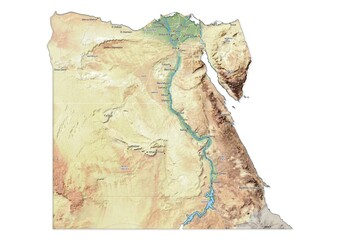
Isolated map of Egypt with capital, national borders, important cities, rivers,lakes. Detailed map of Egypt suitable for large size prints and digital editing.
#497084333
Zobacz więcej
Vibrant Doha, Qatar map - Export concept map for Doha, Qatar on World map. Suitable for export concepts. File is suitable for digital editing and prints of all sizes.
#619782312
Zobacz więcej
Vector Argentina map, map of Argentina for emphasizing export, technology, trade and innovation. Enhance presentations and marketing materials. Ideal for businesses, entrepreneurs.
#599034077
Zobacz więcej
An abstract representation of Palestine,Palestine map made using a mosaic of black dots. Illlustration suitable for digital editing and large size prints.
#590379840
Zobacz więcej
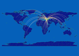
Vector Federated States of Micronesia map for technology or innovation or it concepts. Minimalist country border filled with 1s and 0s. File is suitable for digital editing and prints of all sizes.
#591351463
Zobacz więcej
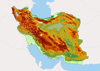
High detailed vector Iran physical map, topographic map of Iran on white with rivers, lakes and neighbouring countries.
#589389389
Zobacz więcej
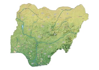
Isolated map of Nigeria with capital, national borders, important cities, rivers,lakes. Detailed map of Nigeria suitable for large size prints and digital editing.
#497084178
Zobacz więcej
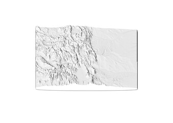
A map of Colorado, Colorado map in joyplot style. Minimalist poster of Colorado map to demonstrate state topography in 3D like style.
#566565375
Zobacz więcej
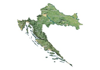
Isolated map of Croatia with capital, national borders, important cities, rivers,lakes. Detailed map of Croatia suitable for large size prints and digital editing.
#497084358
Zobacz więcej
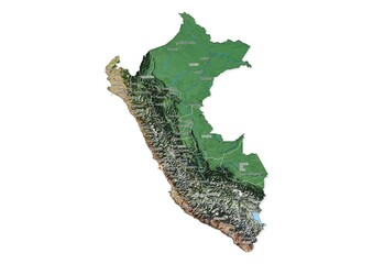
Isolated map of Peru with capital, national borders, important cities, rivers,lakes. Detailed map of Peru suitable for large size prints and digital editing.
#497084141
Zobacz więcej
Isolated map of Brazil with capital, national borders, important cities, rivers,lakes. Detailed map of Brazil suitable for large size prints and digital editing.
#496540663
Zobacz więcej
Isolated map of Yemen with capital, national borders, important cities, rivers,lakes. Detailed map of Yemen suitable for large size prints and digital editing.
#496540182
Zobacz więcej
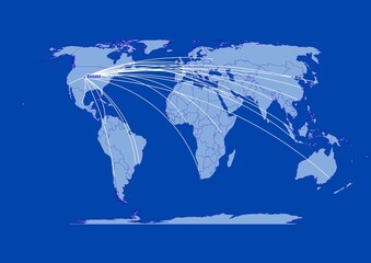
Denver;United States of America,connections of Denver;United States of America to other major cities around the world.
#497641607
Zobacz więcej
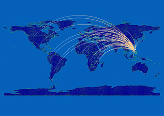
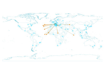
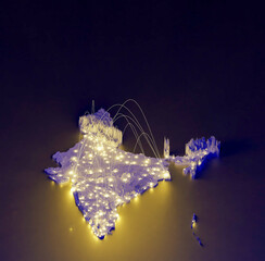
India map for technology or innovation or export concepts. Connections of the country to major cities around the world. File is suitable for digital editing and prints of all sizes.
#497408356
Zobacz więcej
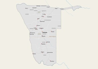
Isolated map of Namibia with capital, national borders, important cities, rivers,lakes. Detailed map of Namibia suitable for large size prints and digital editing.
#497084180
Zobacz więcej
Isolated map of Yemen with capital, national borders, important cities, rivers,lakes. Detailed map of Yemen suitable for large size prints and digital editing.
#497083982
Zobacz więcej
Vector Turkey map, map of Turkey for emphasizing export, technology, trade and innovation. Enhance presentations and marketing materials. Ideal for businesses, entrepreneurs.
#599028230
Zobacz więcej
Namibia concept map centerd on Asia Pacific, export concept map for Namibia on white background suitable for export concepts. File is suitable for digital editing and large size prints.
#531188650
Zobacz więcej
Export concept map for Italy, vector Italy map on white background suitable for export concepts. File is suitable for digital editing and large size prints.
#509526143
Zobacz więcej
Namibia map, export concept map for Namibia on white background suitable for export concepts. File is suitable for digital editing and large size prints.
#508278783
Zobacz więcej
Isolated map of Afghanistan with capital, national borders, important cities, rivers,lakes. Detailed map of Afghanistan suitable for large size prints and digital editing.
#496114756
Zobacz więcej
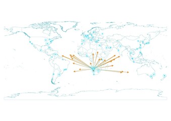
North Korea map for technology or innovation or export concepts. Connections of the country to major cities around the world. File is suitable for digital editing and prints of all sizes.
#497407734
Zobacz więcej
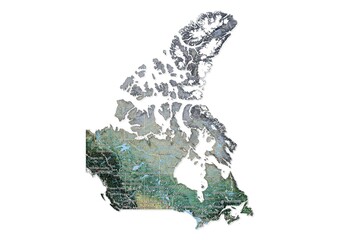
Isolated map of Canada with capital, national borders, important cities, rivers,lakes. Detailed map of Canada suitable for large size prints and digital editing.
#497084370
Zobacz więcej
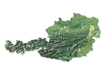
Isolated map of Austria with capital, national borders, important cities, rivers,lakes. Detailed map of Austria suitable for large size prints and digital editing.
#497084399
Zobacz więcej
Namibia map for technology or innovation or export concepts. Connections of the country to major cities around the world. File is suitable for digital editing and prints of all sizes.
#497407369
Zobacz więcej
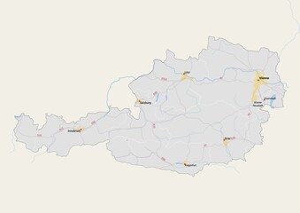
Isolated map of Austria with capital, national borders, important cities, rivers,lakes. Detailed map of Austria suitable for large size prints and digital editing.
#496540688
Zobacz więcej
Isolated map of Namibia with capital, national borders, important cities, rivers,lakes. Detailed map of Namibia suitable for large size prints and digital editing.
#496540353
Zobacz więcej
Kribi, Cameroon map - Concept map for Kribi, Cameroon on World map. Suitable for export concepts. File is suitable for digital editing and prints of all sizes.
#660116610
Zobacz więcej
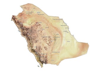
Isolated map of Saudi Arabia with capital, national borders, important cities, rivers,lakes. Detailed map of Saudi Arabia suitable for large size prints and digital editing.
#497084093
Zobacz więcej
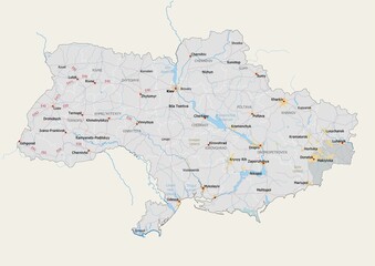
Isolated map of Ukraine with capital, national borders, important cities, rivers,lakes. Detailed map of Ukraine suitable for large size prints and digital editing.
#496540206
Zobacz więcej
India concept map, map of India suitable for technology, export, smart city, development and communication concepts.
#573501389
Zobacz więcej
Isolated map of Morocco with capital, national borders, important cities, rivers,lakes. Detailed map of Morocco suitable for large size prints and digital editing.
#496540360
Zobacz więcej
Vibrant, detailed map for Nigeria emphasizing export, technology, trade and innovation. Ideal for businesses, entrepreneurs. Enhance presentations and marketing materials.
#597475151
Zobacz więcej
Vibrant, detailed map for Jordan emphasizing export, technology, trade and innovation. Ideal for businesses, entrepreneurs. Enhance presentations and marketing materials.
#596559718
Zobacz więcej
Vibrant, detailed map for The Bahamas emphasizing export, technology, trade and innovation. Ideal for businesses, entrepreneurs. Enhance presentations and marketing materials.
#596560315
Zobacz więcej
«
1
2
3
…
217
»
Copyright
Fototapeta4U.pl
2024